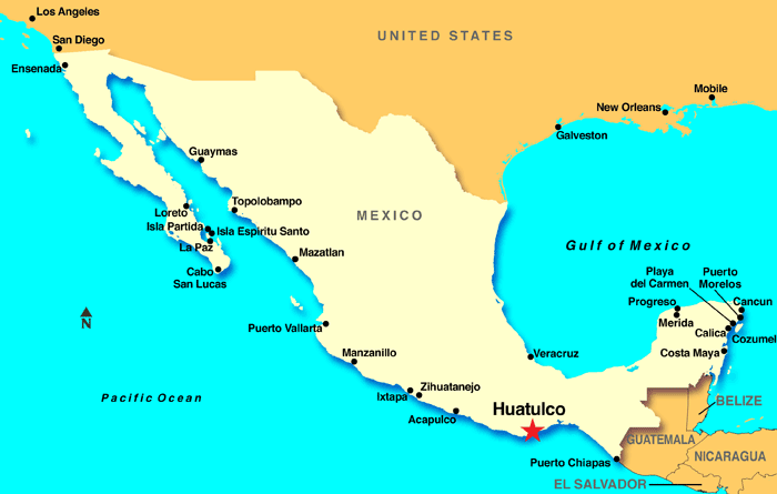
The map of Huatulco Mexico, provides a visual representation of the location of this beautiful coastal town. Huatulco, often known as Bahías de Huatulco, is situated on the southern Pacific coast of Mexico. This popular tourist destination can be easily located on a map of Mexico. It is nestled in the state of Oaxaca and features a series of nine stunning bays and numerous pristine beaches. Travelers looking to find Huatulco on a map of Mexico can simply pinpoint Oaxaca’s coast in the country’s southern region.
Huatulco’s unique charm, with its lush greenery, crystal-clear waters, and vibrant coral reefs, makes it a sought-after destination for tourists. For those wondering, “where is Huatulco, Mexico, on a map?” or “where is Huatulco?” it’s located in the southern part of the country, surrounded by the Sierra Madre del Sur mountain range, creating a picturesque backdrop for its coastline. The town’s location on the map of Mexico showcases its accessibility by air and sea, with the Bahías de Huatulco International Airport serving as a major entry point for visitors from around the world.
In summary, Huatulco, Mexico, is a captivating coastal town that can be easily located on a map of Mexico. Its breathtaking natural beauty, accessible location, and warm climate make it a top destination for travelers seeking sun, sand, and adventure.